 Sunday September 26th (Day 12)
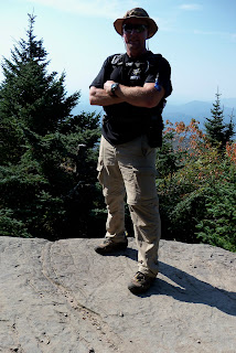
Adam 3 at the summit.

The Catskill Mountain 3500 Club awards certificates and patches to those who make all these required climbs.
Almost immediately after retiring, I traveled to New York and did manage to make it to the top of 32 of those mountains in the first 30 days including signing in at 11 cannisters on trail-less summits.
I later continued the quest by coming back after only a month away and finished out the last three "in season" hikes. The unique part of this quest is that in a departure from the requirements of several other such "peak bagger" mountain clubs, you have to return once again and re-climb four select mountains during the winter season.
Three of those winter climbs have been done. Only one remains. It will be completed in December 2011, hopefully with my close family standing on the top of the last mountain with me.
If you happen on this blog and find any of it of interest to you, please understand that each post shows up as most recent first but, the story actually began back in September-2010. Please scroll back and feel free to look at all of it...
 Sunday September 26th (Day 12)

 We staged one vehicle in the DEC parking area where the Devil's Path begins along Spruceton Rd. and took the other one several miles further down to the dead end. The hike started on the Diamond Notch Trail that I took to the summit of Southwest Hunter the other day. That gave us a chance to stop by Diamond Notch Falls for some pictures before we joined up with the Devil's Path and started the long steep climb up West Kill. Just prior to reaching the top, "Buck's Ridge Lookout" afforded some great views of the Black Dome Range and all the other northern peaks.

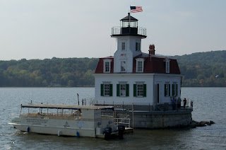
 From there we drove into Kingston and took the Rip Van Winkle boat cruise down the Hudson. Since it was an unseasonably warm day in the high 80's and I specifically chose Fall to make this trip, it was a day better suited for being on a boat than sweating up the back side of a mountain anyway.

 Southwest Hunter is the most recently added summit to the 3500 club. It was originally thought to be a sub-peak of Hunter Mountain, but since it fit the criteria of a separation of at least a half mile between summits and at least a 250' drop at the Col, it qualifies as a peak in its own right. It does not have a maintained trail to the summit, but the Devil's Path leads up out of Diamond Notch to an unmarked trail indicated by the stone cairn pictured below. It was not as steep of a trail like I have experienced the last couple of days, but once you entered the woods and started up hill, it went on "seemingly forever." A narrow and rocky trail that made footing incredibly difficult.


 Sometimes you
 The signs at the trail head at the top of the "old" Mink Hollow Trail.
 As we used to say on the Appalachian Trail, Monday was a "zero" day. No mountains climbed, no miles covered, but we did manage to get to the other side of "The River" and see some of my favorite sites. Sarge doesn't like to pose, and won't sit still long, but I can show off pictures at Walkway over the Hudson...
This is one of those times that you may want to back up to the previous post and
read it first or this one will make less sense. As I have noted before,
this blog posts the most recent comments first and I have set up the background
to these mountains in the previous one...The group for this hike was so big that it was split into two smaller groups. Mine had 16 people in it and the plan was to hit Friday Mountain first as it is the more difficult of the two. The make up of the group was about 50%/50% men and women raging in ages from 22 to 61. You hike at the speed of the lowest common denominator. I should have known what kind of day that it was going to be when one of my group tripped and fell over a log in the first hundred yards.
Sarge and I have been "power hiking" for the last four days, not because I was trying to but only to determine my own pace and strengths. Now with a group, we would climb for a short time, they wait for a while for the rest to catch up. By staying up front, I was able to listen to others who had already done mountains that I haven't and learn some the best ways to complete them.
It was a steep, steady climb all the way up the side of Friday which included two hands over feet 50 foot scrambles up through sheer rock crevasses. I was amazed that a couple members of the group made it through there. As we started our last push for the summit, the same individual that fell 100 yards into the trip, fell again only this time something "cracked."
It was her wrist, which was better than an ankle, but at 3500 feet and her having a panic attack about didn't make it easy. She caused herself to go into shock, passed out for a while, then threw up several times. We made her as comfortable as possible on the closest thing we had to a level spot and wrapped her in a "space blanket" while we tried to make some decisions.
Now this story could go on for a long time so I'll try to give it the Reader's Digest version from here. Both groups met back up. The two guides and one lady from our group stayed with her, while the rest of his pushed on for the summit which only about 20 minutes away. On my first trail-less hike I ended up leading the group up to that one. (top picture) We returned to the injured woman, who was doing somewhat better. The guides had contacted NYS Parks Service Rangers and the local fire department and were waiting for them to make a decision on how to move her. No matter what, it was going to take at least two hours for them to get there. The rest of us made the decision to continue on (still guide less) to the top of Balsam Cap. Following a "herd path" (unmarked, unmaintained, but somewhat discernible path made by previous hikers and animals) we made our over the relatively short distance between the two mountain passing a lookout where I took the above inset picture of the Ashokan Reservoir in the distance.

 Day Five - Friday and Balsam Cap Mountains. (3604 and 3623 feet respectively) Today was a day for a couple of firsts. My first attempts at trail-less summits and first group hike. All the trail-less summits have cannisters like the one on the left. (My first on on top of Friday) Inside is a small memo pad (just like the ones all police officers carry in their shirt pocket) on which you just record your name and the date. No comments, bitches or gripes. Twenty three aspiring members to the club showed up for this hike because the summits have the reputation for being two of the more difficult ones to reach. Group hiking is a double edged sword, because on one side, you have an experienced group leader to show you the way up and back, but unfortunately you have to hike at the group's pace and level of abilities. I'll explain that a little more next...


 the way, if I haven't introduced you to Sarge, he is my hiking companion. He's an 8 year old Springer Spaniel and a total mountain dog. No matter how many miles I do he most likely doubles it because being a bird dog, he moves left to right trying to flush pheasant, quail, and turkeys, not because he knows what he's doing, just because he knows that he has to do it...

 Today may be the only gift that I'll be given on this trip, because the parking area at the trailhead was already at 2700 feet. Much less climbing. Since there is a fire tower at the top of Balsam Lake Mountain, there was a fire road to the top of it. Since even old roads have to follow the path of least resistance it was an easier hike. Unfortunately, there was no need to waste energy climbing the tower, even though the views are supposed to be spectacular, a cold misty rain and dense fog would have kept me from seeing anything. This mountain was 3720 feet, my highest so far for this trip until I ventured off the beaten path for Graham Mountain...

 In order to get to the middle of "no where" you unforturnately have to go some where. That somewhere happens to have been New Jersey. It took forever to get through that traffic, but I did finally get in. It's a 10 hour drive which I did overnight, but I couldn't let lack of sleep get in the way. I had to start right away, because as I would find out later, time and weather work against you.
 The best way to "disconnect" from that way of life is to try to climb as many mountains as possible in the shortest amount of time. (or drink a lot of beer)