35 Peaks in 30 Days

With retirement quickly approaching, I needed to find something to challenge myself both physically and mentally. Since my first idea of a thru-hike on the Appalachian Trail was out of the question, (sleeping on the ground every night for six months is not a just a challenge, it's slightly suicidal) I decided to attempt to hike all 35 peaks in the New York Catskill Mountains that are over 3500 feet in elevation in 30 days.

The Catskill Mountain 3500 Club awards certificates and patches to those who make all these required climbs.


Almost immediately after retiring, I traveled to New York and did manage to make it to the top of 32 of those mountains in the first 30 days including signing in at 11 cannisters on trail-less summits.


I later continued the quest by coming back after only a month away and finished out the last three "in season" hikes. The unique part of this quest is that in a departure from the requirements of several other such "peak bagger" mountain clubs, you have to return once again and re-climb four select mountains during the winter season.


Three of those winter climbs have been done. Only one remains. It will be completed in December 2011, hopefully with my close family standing on the top of the last mountain with me.


If you happen on this blog and find any of it of interest to you, please understand that each post shows up as most recent first but, the story actually began back in September-2010. Please scroll back and feel free to look at all of it...


Sunday, March 27, 2011

Wrapping it up for the season...


So... One more time, I'll pack this blog up for a little while and get back to reality. Even if we could have gotten the last mountain in, there likely would not have been enough time to submit my paperwork and still be able to receive my certificate and patch at this year's 3500 Club banquet in April. If everything works out as currently planned, I'll still be able to finish in 2011 which always was the original goal.


With that, on Monday (03-28-2011) I go back to work after a six month sabbatical which included, of course, my climbing these 38 mountains. Since I've known nothing but Law Enforcement my entire adult life, I'll return to it, but this time with a State agency working directly for the North Carolina General Assembly. Politics and mountain climbing do kind of go together. Either way it seems like you are always fighting gravity...

Friday, March 25, 2011

Panther Mountain - Winter Hike #3 (03/20/2011)

I'm not exactly sure what criteria the 3500 Club used to choose Slide, Blackhead, Panther and Balsam as the select mountains that would be required for the Club's "four" Winter hikes, (maybe I could have researched that a little better before I open my mouth) but I'll go out on a limb and guess that at least one of the reasons was location. These mountains represent the Southern, Northern, Central and Western areas of a mountain range that spreads out over four counties in a huge part of upstate New York. Many people forget, or just don't know that upstate New York, (well beyond the confines of New York City) really has some of the most incredible scenery as well as having been a witness to much of the most important early history of our country. The geographical separation of the these mountains makes it difficult to do more than one summit in a day especially during the shortened daylight hours of the winter season. The trail heads for Slide and Panther are relatively close together compared to the others, but given the fact that a trip to Panther actually includes a climb over a second mountain (Giant Ledge) and back, it became our single goal for the day to get to the top of Panther and back to the car before we started the long drive back to North Carolina. The weather was perfect. You can't beat temperatures in the high 40's for mountain climbing when there is no threat of rain. This is one of those climbs that as soon as you step into the woods, you immediately start going up. You continue that climb until you get near the top of Giant Ledge. This is a mountain summit in its own right, but due to the fact that it's only 3200 feet, it doesn't count for the 3500 Club. The views however are spectacular and it is a very popular destination. The real climbers continue on to Panther. To get to Panther, we actually have to go back down in elevation to a col before we start the climb back up to the summit. I'm very lucky because Sandy is one of the toughest girls that I have ever met. She sticks with me, never complains and climbs mountains as well as any of the strong, young police dudes that my son Dave brought up with him back in the Fall. We (of course) made it to the top... Kind of surreal only because there is just one mountain left to go.


I won't get done on this trip. But...


After some careful consideration; I think that a trip back up in December with all of my family with me while I finish this on the top of Balsam Mountain might bring the perfect end to a long but fun journey... Hollywood couldn't have written a better script...

Thursday, March 24, 2011

Blackhead Mountain - Winter hike #2 (03/19/2011)

This is the one mountain that during the Winter season seems to cause the most anxiety. That probably has a lot to do with the fact that an experienced hiker died there last year during a "freak" 8 foot snow storm. A number of different "perfect storm" issues had come together to cause that tragedy, but I had assured all of my family that voiced their concern about us that if anything didn't appear to be safe, we would turn back and live to climb another day. Having climbed most of these mountains by myself, I know that I have tempted fate from time to time and taken several chances. It's a little different when you are responsible for someone else's safety... When we reached the trail head in the morning, it was significantly colder than the previous day's hike and we had dressed accordingly. I had planned it out to take the red blazed Black Dome trail up to the col between Black Dome and Blackhead, push on to the summit (notice how the DEC sign in the picture to the lower left points up?) and then come down the back side of Blackhead along the Escarpment Trail. I have been over Blackhead on the Escarpment twice before and knew to expect an extremely steep descent.


The trail up climbs continuously through hardwood forests and is aided by a couple of "switchbacks." True to form, our "clear but cold" weather at the bottom changed to near blizzard conditions for about 30 minutes near the top. About an inch of snow accumulated quickly before it all blew past and and the sun came back out. It's this unpredictability that gives this northern Catskill Mountain it's reputation in Winter.


We actually ran into two people along the trail that I had previously climbed with back in the Fall. It truly is a "hiking community" of people that love these mountains and come back time and time again.


At the summit, we met up with a group of SUNY Delhi students who had climbed up from the direction that we intended to go down (the steep backside of Blackhead). They passed on to us their concerns about the treacherous ice conditions that they had encountered on the way up and were nice enough to oblige us by taking our summit picture. I did listen to their comments, but I still thought that we could press on down through the icey conditions. I guess that the next clue that should have registered with me is that the trail down literally starts off a small cliff. At the bottom of this cliff, we met three other climbers who were adamant that they had so many problems getting up, they warned that our trip down would be extremely dangerous without ropes and an ice axe.


So... remembering what I had promised, we turned around and went back down the way that we had come from. We had made it to the summit so that qualifies the climb. The way that we come back out doesn't matter in the grand scheme of things. It was actually a longer distance than the route that I had projected, but hey... we didn't slide off the back side of the mountain. We made it safely back to the car, pulled off all the climbing gear and set the GPS to take us to the Mountain Brook Inn over a peaceful back roads country drive. There aren't many places that you can still get Genesee Beer on tap. So, taking that into consideration and the interesting conversation (Sandy can truly talk to anybody) with a bartender who has a reputation for knowing everyone made for a good finish to this mountain.

The dinner that was included in our package at the Alpine Inn was.... (Of course) Corned beef and Cabbage. What else could you expect in the mountains of New York over St. Paddy's Day weekend? It was by far the best that we had eaten during the trip but it was only just one part of a multi-course dinner that was fantastic. We staggered, full of food, back to the room to prepare for our one last day of climbing...

Wednesday, March 23, 2011

Slide Mountain in Winter (03-18-2011)

As we drove north the previous day, I was relieved to see almost no evidence of snow even after we had crossed over the NY state line other than what had been piled up by plows near the edge of parking lots. The snow was really only a concern because neither of us had snowshoes and I wasn't sure if I wanted to take on that additional expense just for the short time that we would be up here. Checking out the weather forecast in the morning, we knew to expect uncharacteristically warm weather throughout the day, but as we drove into the higher elevations, it was obvious that it was still winter up there as the temperatures dipped and we saw how much snow was still on the ground.


At the Slide Mountain trailhead, I had some initial concerns (that Sandy had actually noticed and asked me about it) that started to seep in after I took a quick trip through the snow and behind a tree for a little privacy to "take care of some business." I was sinking in two feet with each step, making me start to question my equipment choices. To add to it, we then watched several other hikers don their snowshoes, but after signing into the trail ledger, I finally got my first glimpse of what appeared to be a packed down trail leading up the mountain.


Now... I wish that Kahtoola would give me a promotional perk for saying this, but their Micro-Spikes (even though they do look like a "Medieval" torture device) are really the best quality slip-on footwear for traction on hard packed snow or most ice conditions available. If you're not climbing Mt. Everest and the current conditions don't require "full crampons" and an ice axe, you will feel totally secure while climbing with this equipment.


Slide Mountain - The weather was great. You can't beat temperatures in the 60's when you are heading to the top of the highest mountain in the Catskills in mid-March. Other than the initial water crossings, (see Sandy's picture above on right) we didn't have any issues to slow us down. When approaching the summit from the front side of Slide, the trail is mostly a moderate climb and easy to follow. We made it to the top in less than two hours, and after a couple of great photo-ops, we worked our way back down.


First Winter climb out of the way, only three more to go... After getting a later than initially desired start, doing a second climb on the same day wasn't an option, so we checked into the Alpine Inn, cleaned up and headed to town for some pizza.

St. Patrick's Day 2011


One of the unintentional, but added benefits to making the trip back up this weekend was arriving on St. Patrick's Day. People in New York take this day so much more seriously than those in North Carolina. We spent most of the day driving around the Hudson Valley, eating "corned beef and cabbage" for lunch (and later again for dinner) and drinking a couple of green beers. The several different Irish pubs that we stopped at were all filled with green clad revellers and traditional Irish music even though it was "technically" still a work day. We settled in early that night to get some sleep before making the last push up into the mountains early the next morning.

Wednesday, March 16, 2011

"The Adventure Continues..."

One of the more prized gifts that I received when I retired was a leather bound photo album from my wife that she had engraved to say,


"Dale R. Mead

The Next Adventure..."


Since that time, with many mountains and miles behind me, I have filled it with pictures, written captions and memories of sore muscles to document this challenge so far. On Thursday, March 17th 2011 we will head back up to New York for the weekend to attempt the last four "winter climbs" necessary to complete my requirements for the "Catskill Mountains 3500 Club." If we can't finish them, I may have to send the book back out and have it engraved one more time to acknowledge that the "Adventure Continues..." So... with only four more mountains to go... in winter, with snow and a good bit of ice still on the ground... we venture on. No small task, even if it happens to be near the tail end of the accepted winter season for the club. (12/21 - 03/21) Regardless of where you may live, this winter has been tough on everyone. (insert global warming theories here) Upstate NY however, has been pumeled by snow. The bad weather has continued and besides the fact that the snow in the higher altitudes has not yet decided to melt much, there has been a large amount of rain lately that has contributed to flooding conditions just like what I (we... Sandy and I) had back in early October. I have continued to keep track of the 3500 Club's message board on-line and paid particular attention to those posts that include, "deep snow, difficult conditions, and most recently, tough access to trail-head parking."


I do love a challenge.

Saturday, November 20, 2010

Lone & Rocky Mountains - 3721 & 3508 feet

Time becomes your enemy when you climb mountains in the late Fall and Winter. Especially since we had just made the change to standard time, it's important to plan your hikes so that you get off the mountain by 4pm. That being said, yeah, well... it didn't happen. There's no reason that my last two mountains shouldn't have been filled with drama, but then again without it then this post wouldn't be interesting.
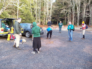


0800 Sunday, November 14th - An early meeting to start heading towards the two most remote mountains of the Catskills 35. From my hotel room in the middle of nowhere, it still took almost an hour to get to the trail-head which after a long drive to start with it still started at the dead-end of Denning Rd., a 10 mile long trip through a beautiful valley that fit the usual characteristics: it starts off as a two lane divided road that narrows down to a paved two lane road, that narrows down to a one lane paved road that narrows down to an un-paved road that narrows down to a dirt trail to the dead-end where there is a parking area for crazy people who apparently want to get completely away from civilization. This is where I would meet with other aspiring Catskill 35'ers to complete my last two regular climbs.

I went on my first group hike back on September 19th to Friday and Balsam Cap Mountains. If you dig back far enough on this blog, you will find descriptions of both and the drama that ensued. I initially took on that group hike in order to get experience on how to find the "needle in a haystack" canister on the top of these trail-less summits. It was an "eye-opening" experience that left me initially concerned that there was no way that I would be able to do some of these on my own. Enter... technology. As I have said in past posts, a cell phone was once thought of as an evil device, not to be brought on long hikes where it would ruin the nature experience. It was just a reminder of everything that people were trying to get away from. Now, as we all know they can be life-savers and most climbers wouldn't be caught out there without one. At some point in the future, I think the GPS will share the same sentiment, but for now some people still refuse to think that their compass is not all knowing. This, of course is just an argument about "old school" and "new school", but I will start it out with my personal disclaimer that says: "have a compass, good maps and know how to use them... always"

Lone Mountain - Once you do a couple of these group hikes, you meet up with people that you have seen before and will see again on future hikes. Some fun, some not so fun. Some will just plain annoy the "shit" out of you... My wife will tell you that I probably need medication, but there are some people that just really irritate me. These groups tend to always have at least one person that talks entirely too much and one out of shape, beyond middle age female that should really reconsider her weekend activities. Twenty two people showed up for this climb and the Park Rangers really don't want groups of more than eight to venture out together due to the effect that it has on the environment, so this large group was split in half. I initially ended up in the first group that would be led by an experienced hiker, but not an official 3500 club leader. I had no problem with this because I really thought the he would likely move along a little faster. Now... I refrain from using any real names because eventually someone that I have gone with on a group hike in the past will stubble upon this blog and I'll end up with a bunch of comments about hurt feelings, but after an individual with a reputation for not "ever shutting up" all day made his way to my group, I took the first opportunity to jump ship and join the second group. This too, would come back to haunt me. This new group included a younger female hiking in a skirt who I never could quite figure out, a couple other folks who I had climbed with before, and oh... that one lady who should probably should have reconsidered.
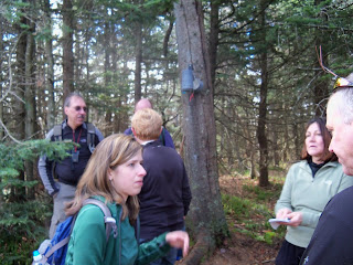


From the dead end of Denning Rd., you start off on the Phoenicia East Branch Trail. A wide, old wood road that is relatively easy for the first mile that brings you to the blue blazed trail that would take you on to Table and Peekamoose Mountains that I already completed on October 6th. After two stream crossings that included the "bridge of death" you have to break off on the unmarked "Fisherman's Trail" that follows the Neversink Branch to a point where finally after four miles into the hike you actually start to head up Lone Mountain. (maybe this is one of the reasons that they call it "Lone") At over 3700 feet, there is still a long steady climb to the top. I kept a close check on my GPS as the group leader took us up based on his compass bearing. He had commented on my GPS earlier and asked me from time to time what I thought. I respect the time and responsibility that these volunteers take on to lead groups of varying abilities to the tops of hard to find summits and never try to overshadow them or tell them how to do their job. Unfortunately, every once in a while somebodies got to be in charge...

With time being much more of a consideration than it was to me last month, we found our way to the summit of Lone Mountain and it's canister a little later than I had hoped, but at that point there was no cause for concern. You move at the pace of the weakest climber in the group and that is fine, because for safety reasons, you never want to get too separated. Our group leader made the good decision not to spend too much time at this summit once everyone signed into the canister, but once he made the call to move on, one person in the group (guess who) commented that she "didn't feel very well and didn't know if [she] could go on." There are no roads to or near the summit and we are more than five miles into the wilderness. The happy ending to this part is that she was just slightly dehydrated and the electrolyte boost from a bottle of Gatorade was all she needed to get back on track. The down side... the delay caused our guide to rush his decision when finding our next bearing for the trip to Rocky.

At 3508 feet, Rocky Mountain is the smallest of all the Catskill 35 peaks. You actually have to come down 200 feet in elevation from Lone to the summit of Rocky, however it is very difficult due to the thickness of the Balsams and undergrowth between the two summits. Instead of following the correct bearing however, we took the "path of least resistance." As much as I wanted to stay in "retired" mode, I commented that we might be heading in the opposite direction from where we needed to be. Our guide assured everyone that this was the way he wanted to go because the next ridge down was level and he wanted to walk around the "bowl" to Rocky. I continued to pay close attention to my GPS and as my concern grew, I said said once again... "we are heading in the complete opposite direction of where we need to be." This second comment caught the attention of several other people in the front of the group. Our guide stopped, pulled out his compass, checked the bearing and said "well I am a little off where I wanted to be, but this is still what I wanted to do." From there, the next hour became a war of wills. The cross over to Rocky should have only taken 45 minutes. We had gotten to the point where each time the guide stopped and said we need to "go this way," the group would all look at me and I would have to just point off in a different direction. Each time that my GPS was right, the guide would "yeah, but I needed to keep this rise of land over here" or something else to save face. Finally when he realized that we were way off course, he actually looked at me and said "why didn't you say something?" Fighting off what the real Dale wanted to say, I just replied that "I did... twice." I really hated the whole thing because the guy really knows what he is doing, but just got off track a little bit. (okay, well a lot this time) At one point a lady from the group said, "if we have to go to the life boats, I want to be in yours." The tough trick here was hitting a small col between the two mountains which was actually kind of flat and then pushing through the thick evergreens to the next canister. By this point our guide had accepted the GPS reading and kept asking me what I thought. Once again, the machine (the GPS, not me) lead us directly to the canister as it had done for me numerous times throughout this quest. The guide thanked me but I told him as I have said before, the GPS is not "old school" but it is fool-proof as long as you have batteries.


His plan to get back down made good sense. The contour of the land funnels you down in between two streams. In the late fall you can see Slide Mountain and as long as you keep it in front of you and head slightly to the left, you will make your way back down to the "Fisherman's Trail" where you start a long six mile hike back out. The only problem... we have lost much valuable time and the sun sets earlier in deep valleys than anywhere else.

At this point, (and I don't blame him) our guide starts off like a man on a mission. At least two hours behind, we need to make up as much distance as possible before dark sets in. We are on a trail but many parts of it were washed away during the floods that I was here to witness back in September. This included several deep stream crossings where our guide, who was likely tired and trying to make time, walked across with high top Gortex boots, leaving me to try to find stable rock crossings for some of the ladies that didn't need or want to get their feet that wet, especially with night closing in. Somewhere around this point, one of the group, a guy that had been near the front all day complained (and rightfully) that we were moving way too fast and that he was hurting too much to continue on at that pace. The decision was soon made to put on head lamps and continue on slower, and making sure that we weren't getting separated by too much. The Fisherman's Trail is sometimes hard to follow even in daylight because of the recent storms and at night as you may imagine it is much worse. Moving slower so that everyone could keep up, we finally reached the marked "blue blazed" trail that led back across the bridge of death at night and then to the last mile back out along the wood road to the parking lot. My GPS recorded it as a 12.9 mile hike, the longest of any that I had done in order to complete the Catskill 35's. I guess that it's only right that the last should be the hardest, but I guess that I actually planned it that way. I do love a challenge. We came out of the woods at 6:00 pm, an hour and a half after dark set in. I was equipped to spend a night in the woods if necessary, but I really didn't want to in NY in November.
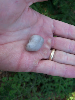

When I was on top of Indian Head Mountain on October 11th and knew that it was time to head back home for a while, I looked down and saw a white stone on the ground beneath the canister that looked different than anything else around it. I picked it up and put in my pocket and when I got back home I set it on my dresser as a reminder that I wasn't done and I needed to go back. I carried that stone back up there with me and when I signed into the canister on my last regular hike, (#35) I dropped it on the ground to the finish the connection of the "35 peaks in 30 days." The timing was a little off, but the task is complete...