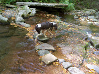
35 Peaks in 30 Days

With retirement quickly approaching, I needed to find something to challenge myself both physically and mentally. Since my first idea of a thru-hike on the Appalachian Trail was out of the question, (sleeping on the ground every night for six months is not a just a challenge, it's slightly suicidal) I decided to attempt to hike all 35 peaks in the New York Catskill Mountains that are over 3500 feet in elevation in 30 days.

The Catskill Mountain 3500 Club awards certificates and patches to those who make all these required climbs.


Almost immediately after retiring, I traveled to New York and did manage to make it to the top of 32 of those mountains in the first 30 days including signing in at 11 cannisters on trail-less summits.


I later continued the quest by coming back after only a month away and finished out the last three "in season" hikes. The unique part of this quest is that in a departure from the requirements of several other such "peak bagger" mountain clubs, you have to return once again and re-climb four select mountains during the winter season.


Three of those winter climbs have been done. Only one remains. It will be completed in December 2011, hopefully with my close family standing on the top of the last mountain with me.


If you happen on this blog and find any of it of interest to you, please understand that each post shows up as most recent first but, the story actually began back in September-2010. Please scroll back and feel free to look at all of it...


Wednesday, October 27, 2010

The Towns... (Part 2)

Some of the towns in the area didn't serve any logistical purpose, but just provided a destination to get something different to eat or drink.


Woodstock - This is a town still stuck in the sixties but that's the way they like it. Their marketing is still playing off the nostalgia of the 1969 concert that bears the same name but actually took place many miles away in Bethel, NY. Left over hippies still walk the streets and head shops and psychedelic clothing can be found all through town. Sandy and I ate lunch here on her first day in the mountains before the floods hit. We didn't shop, the "it's 4:20" theme plays out quickly for me.


Saugerties - A historic Hudson River town with a vibrant down-town filled with antique shops, restaurants and a couple of bars. One bar in particular, the Exchange Hotel Bar and Grill, fit the bill while my son and his friends were up there just because it was one of those places that had the same people sitting on the same bar stool they were twenty years ago, only older and heavier. Draft beers are only $1.50 a mug and the place is dark and old. Very NY and just the way I like it.


Wednesday, October 20, 2010

The Towns...

Unlike my long trip on the Appalachian Trail years ago, I wanted to make sure that I had daily access to food, supplies, cold beer and of course, my computer this time. The ability to climb one or multiple mountains during the day and still come back to civilization (such as it may be) in the evening made for a more comfortable and interesting trip. The towns in the area played an important part because no one town had all the necessities that I required to sustain me and since I had to cover a lot of ground each day just getting to the trail heads, I had the opportunity to visit (and make use of) many of them.


During the early part of the 20th century and continuing on into the mid 1960's, the Catskills were known for being one of the entertainment capital's of the world. People would escape the heat of metropolitan New York City and make the two hour drive to the fresh air and peacefulness of the Catskills for rest and distraction. Many notable comedians, such as Rodney Dangerfield, Lenny Bruce and Don Rickles to name only a few, got their start as well as many other nationally known performers at the large resorts in Sullivan, Orange and Ulster Counties. Although it was mainly recognized as the "Borscht Belt" or the "Jewish Alps" during this time, there are many other areas of the Catskills where other ethnic groups such as the Irish and Germans settled and also created their own vacation destinations. Unfortunately, modern conveniences such as air conditioning and the availability of cheaper airfare lead the next generation to travel to more exotic vacation destinations and the Catskills began a slow descent into obscurity. Most of the large resorts either have been demolished, burned to the ground, sit in ruins or have been re-purposed into retreats for Orthodox Jewish families. The towns that once thrived on the resort crowd have been left to survive on summer hikers and campers, Fall leaf peepers and the ski season. The recent decline in the economy has added to the problem and many restaurants, businesses, and motels sit closed and empty.


The town's for me were somewhat of a life-line. A few had coveted cell-phone service, others had actual grocery stores, Phoenicia had an outfitters, Tannersville and Arkville had Laundromats and most had at least one interesting bar to sit, relax and listen.

The Catskill Park consists of 700,000 acres. Each of the many towns, villages and hamlets that lie within the "Blue Line" (Boundary of the Catskill Park) have their own quaint little post office, but there are too many to mention. I'll try to touch on just a few that had the provisions that I needed to keep this trip going:

Phoenicia - This was home base. If you look at a map of the Catskills or if you match up the four main Catskill Trail maps you find that Phoenicia is pretty much the geographical center of the park. It has an energetic village (especially on the weekends) with diverse shops, a dependable outfitters store and several good places to eat. I happened upon Phoenicia about ten years ago when I was planning an 18 mile hike on the Escarpment Trail with my son Dave. I researched the history of the town and found out that the Hotel Phoenicia had served the likes of "Babe Ruth" and the famous gangster "Dutch Schultz." www.castkill.net/purple/schultz.htm It seemed like a great place to stay and it didn't disappoint. The bar was great, (they actually let me bring Sarge in) the rooms were clean but small since you could probably sit on the toilet and take a shower at the same time. There were likely some ghosts, but it was such a great place that we came back the next year with Kaiyln and my younger son Dan for another go at the Escarpment and a good conversation with some of the hotel regulars. Unfortunately, like so many other historic places in New York, it burned to the ground in 2007.


Phoenicia is also known as the setting for the "B" movie Wendigo [en.wikipedia.org/wiki/wendigo_(film)] Decent story, poor special effects, but some of the filming occurred in downtown, especially at the Phoenicia Pharmacy. The historical part of the town's legacy is the fact that it was the first mountain town to receive rail service but today it is mostly known for "tubing the Esopus River." Large tire tubes with wooden boards tied to the bottom side to keep your "ass" from bouncing off the rocks as you negotiate the rapids. It's fun and Sandy survived it last year, so it's safe too.

For my purposes, there was a good bar... the "Sportsmans." This is attached to Brios Restaurant which had the best NY pizza and very good mexican food. There is a higher level Italian restaurant, Ricciardellas, down the street which I tried to eat at but was closed and Al's, a sea food restaurant that was quiet and good place to take Sandy for dinner while she was there.

Although I have made fun of this town in the past, calling it the "place where hippies not cool enough for Woodstock go to retire", I hope that the old guy with the long grey beard pulling the oxygen tank around downtown yelling at everyone will forgive me. If Phoenicia just had a Laundromat, I might not ever have had to leave. Unfortunately, I was here for a month and didn't have a month's worth of quality hiking clothing so laundry had to be done at least once a week. So that takes me to Tannersville...

Tannersville - I really don't mean to make this a history lesson, but Tannersville was founded in the 1800's around lumber mills and the tanning industry. This town comes alive during the ski season, but if you come here in September in-between the summer and fall leaf seasons, the place closes down. But... it does have a Laundromat. I brought my dirty, sweaty and sometimes blood stained clothes here on several occasions. At times, I was there by myself and at other times this was laundry central for all the locals. In the land that time forgot, only about 75% of the washing machines worked and maybe 50% of the dryers. All in all, it was the least expensive of the Laundromats that I would use and had the best (and fastest)dryers.


Tannersville also had a Grand Union grocery store for fresh meats, vegetables and fruit and a gas station that I happened to have a card for. The one open bar in town during this season gave me a place to have that one perfect beer at the end of the day while my clothes where drying.


Hunter - Hunter Mountain is the second highest moutain in the range and is also the location of one of the most popular ski slopes. It is a quiet town with most of the tourist activity at the resort area at the base of the slope. This used to be the site of Hunter Village Inn which also burned to the ground several year ago but there is one nice Irish Pub in town and there are great off-season views of the ski area.


Arkville - A small old railroad town as you continue west on NY Route 28. It get busy during the fall season as weekenders board the train to view the fall colors. There isn't much else here other than a pizza place and another laundramat. It is cleaner and better maintained than the one in Tannersville, but is also more expensive. It does actually have a bathroom which saves you having to run around to the back side of the building.


Monday, October 18, 2010

Glossary

As I finally get around to writing thank you notes for the retirement gifts that I received, I am going include a note explaining the delay due to my trip to the Catskill Mountains. I thought that while I was up there that I would have had plenty of time to complete them, not realizing that each day would end up consisting of: get up, drive to trail head, climb a mountain or two (or three), return to the cabin, eat, go to bed early, repeat...) Since I plan to include a link to this blog for anyone that is interested on that note, I thought that I might try to set the stage for any newcomers.

Some mountain terms are universal and understood almost anywhere, but there are some that are unique to the Catskill Mountains and Hudson Valley due to the original Dutch settlers of the area. The following terms are used by most all hikers in the Catskills and are repeated frequently in my posts:

Bushwhack - An off-trail hike, usually requiring a compass and map. (or GPS)


Cairn - A pile of stones that marks a summit or the route.


Cannister - PVC container located on train-less summits of Catskill Mountains more than 3500 feet in elevation containing a notepad ledger and pencils. (bushwhacks)


Col - A pass between adjacent peaks in a mountainous chain or a low spot in a ridge.


Clove - A narrow valley.


Herd Path - An unmarked, unmaintained path created by hikers or animals.


Hollow - A small valley.


Kill - A Dutch word for waterway, creek, or river.


Lean-to - A three sided shelter with an over-hanging roof for camping.


Logging road - A crude road used to haul logs after lumbering.


Notch - A narrow pass.


Summit - The top of a mountain.


Vly - Dutch word for swamp or marsh.


Woods road - An old unmaintained road or logging road.


Since the most recent posts appear first in the blog and work their way backwards to the early planning stages of the trip, I hope this may be helpful to those who may have just started reading.

Friday, October 15, 2010

Packing up (for now)

The map board gives the overall big picture of the trip. 32 completed mountains spread out over the four NY Counties that make up the Catskill Mountain range. I put over 1200 miles on my truck driving back and forth to trail heads that were mostly found at the dead end of long valley roads along brooks and streams with great scenery all around. The small number of pictures that I was able to post can't even begin to do it justice. Hopefully during the interim before I come back to finish the last three (non-Winter) hikes, I'll be able to keep the blog going by putting up some of the numerous other pictures that I took and explain some of the back stories that went on behind the scenes when I wasn't on a mountain.


The planning for this trip began several months ago, some of which probably occurred on City time, but even while in the mountains it continued on a nightly basis. As a firm believer of "no plan survives the first contact intact," I often had to re-adjust take off points, change the order of climbs, modify the gear in my pack depending on terrain, find different trails away from streams due to water levels and and re-route drives to the trail head due to flooded roads.


All things considered, this part of the trip has been a complete success. Especially due to the fact that early on, after my first bushwhack climb to Friday and Balsam Cap Mountains with the group, I questioned my ability to find canisters on my own and had downgraded my overall goal to possibly 25 or 27 total mountains for the trip. Everyday proved to be a learning experience and through a combination of planning, perseverance and just plain being stubborn I managed to find 8 of the 14 canisters on train-less summits on my own. (and a little help from my GPS) Three others were achieved on group hikes leaving only the last three remaining Catskill 35's to go.


So, on Tuesday morning October 12th, I shaved, cleaned the cabin, packed up the truck, loaded up the dog and said good-bye to the town of Phoenicia and the Catskill Mountains for a little while. I'll try to write more about Phoenicia (and the other mountains towns that I frequented) in another post, but I think it can be best summed up as the "town where hippies not cool enough for Woodstock went to retire." It is quaint, but odd.


For now... a trip across the river to have lunch with my brother and his girlfriend and then the 11 hour drive back to North Carolina. In about a month, when I have things back in the right perspective... I'll be back.


Monday, October 11, 2010

Big Indian Mountain - 3700 ft.

(This post was re-edited on 10-14-10 with new material)
Today was the first day in about three weeks that my legs were still pretty shaky in the morning. Yesterday's climb took a lot out of me and totally did in Sarge. I can't blame him because I would have laid on my bed most of the day too if I could... I didn't, I got up and went on to Big Indian.


In order to reach this peak, I would have to re-cover some ground that I had already gained twice in the past. I started at the Seager Trail head which had also been the take-off point for Eagle and Double Top. The only good part is that the water has had more of a chance to recede making stream crossings easier and in some cases actually possible. The first two miles are flat until you get to the Shandaken Creek lean-to shown above. At that point, you cut back east and start a one mile steep and rocky climb to the col. Still a little irritable and tired from yesterday's "ass-kicker", I had a lot of time to dwell on the fact that this mountain could have been done and out of the way on two occasions already. When I climbed Eagle on October 2nd, I had made the very same steep ascent that I was cursing my way up right now. This trail makes 85% of the elevation gain you need for both mountains. When you reach the intersection of the blue blazed Pine Hill trail at the col, a left turn will take you a mile to the top of Eagle and a right turn goes a mile and a half to Big Indian making it very possible to back track and hit both in the same day. (This would added another three miles round trip, but would have "killed two birds with one stone") Having planned most of these climbs out over a month ago, I chose to just get Eagle since Big Indian was supposed to be included in an upcoming two summit group hike. (If you read my October 9th post about that hike, you know that we never made it on to Big Indian after wandering around aimlessly on the summit of Double Top for more than 30 minutes and a general lack of group majority interest) So... with one missed opportunity on my own and one cancellation with a group, I find myself losing another precious day finishing a peak that should have already been done when I had climbed 8/10 of the way up it the first time. To make matters worse, over the last couple of days, more than three weeks into this and with 31 mountains behind me, my patience is starting to wear thin and I have started making some things more difficult for myself than they need to be. Big Indian is technically a bushwhack, but considered one of the easier ones because a marked trail passes very close to the summit leaving just a short 2oo yard trek through the woods. Over the years, the vast number of hikers who have gone to the summit have left behind a well used herd path leading right to the canister, or at least that's what I had read while planning this. When I hadn't come across it by the time I thought that I should have and the trail seemed to be starting down the other side, I second guessed myself, pulled out the GPS and broke left off the trail into the thick underbrush towards the summit. It ended up taking me about 45 minutes to go 200 yards and locate the canister myself when a little more patience would have taken down the original trail a short distance further where the obvious rock cairn would have pointed the way to the obvious path that led right in.


I took the usual summit picture, but this time did so with a smile on my face, because I had used the solitude of the climb to come to a good decision. A variety of factors had me pushing myself harder than intended lately. I had originally planned in four rest days (one each week) to give my body a chance to recover. Those would have been more than made up by the number of multiple summit days that I would be doing. (Seven multiples completed, an eighth had to be broken into two consecutive days due to rain and a ninth was lost to poor planning) The weather proved to be an uncontrollable and relentless factor to deal with. Four days where lost to torrential rain and flooding. I had already taken one of the rest days prior to the storms and took another one afterwards to help with Fall chores at my mother's house, giving me six total days completely off the trail.

Another factor that was pressing me for time was the calendar. Although I named this blog "35 Mountains in 30 Days", in reality I only had 28 days since the cabin was only leased for four calendar weeks. It was Monday, and although theoretically it was possible to finish three more in two days, I came to the realization on the mountain that afternoon that I had recently started doing this for the wrong reason. For the first three weeks, each day was an adventure and I looked forward to getting on the trail every morning. For the last several days, I'd become a machine, adding in extra miles and summits to make up lost ground and powering through climbs just to get them done and out of the way. It was starting to take a toll on my legs and my common sense and that is when you tend to make mistakes that you can pay dearly for above the cloud line.
I've decided that when I complete this challenge, I want it to be a celebration on top of that 35th mountain. Not... "I'm so glad that this shit is over!" With what have been described to me as the two most difficult and remote peaks left to go, I think that it is time to call a time out and pack up and head back home to civilization and refresh for about a month. One of the nice things about retirement is that I don't have to check my schedule in order find time to come back. I'm guessing that my calendar is pretty clear.
To be continued...


Sunday, October 10, 2010

Mount Sherrill & North Dome - 3540 ft. and 3610 ft.

This ended up being the most deceiving climb of the trip so far. Being two of the lower mountains in elevation, you get lured into the false sense of security that you can hit both of them in the same day with no problem. The maps did tell a different story when I studied them, but I don't think that I took them seriously enough. The other problem is that bushwhacks are always a "wild card." First off, I'm sure that they are called a bushwhack, because every bush snaps back and whacks you in the face. Some that I have done had well used unmaintained trails or herd paths that lead you right to the summit. Some have gone through open forest without much under growth to slow you down. Some have been steep climbs with rock scrambles, but this one seemed to incorporate all of the worst parts of every other one.
First, it was a long climb to the first mountain and the elevation gain from the parking area coming out of the valley was one of my highest. The climb to Sherrill started out following a wood road, but once that phased out, I had to make my own way. Even with the GPS, staying on the ridge you want can be difficult because the terrain forces you to follow it where it wants you to go sometimes. The ascent to Sherrill is about two miles "as the crow flies" but who knows how much you actually go when you have to cross through hollows and avoid obstacles in your path. It ended up being another one of those mountains that you start to see light up ahead of you and think the summit is coming up only to find out that there was another steep climb over huge rock ridges beyond that.
This was a pick up hike and my mother was going to be at the West Kill Mountain trail head (Devil's Path) where I had planned to bushwhack my way down to at 1:00 pm (my normal 2 MPH estimate for this mileage) By the time I made the summit of Sherrill, I was already close to a hour behind. Cell phones are mostly useless in the Catskill Mountains except at most summits and unfortunately this one was remote enough that it didn't count.
This gives me a chance to make my next complaint about bushwhacks... you lose things. (not the mountain's fault, just poor planning) I almost lost my camera a couple of weeks ago because coming down the backside of one mountain a tree branch grabbed the strap and pulled it out of my camera case. Luckily not long after, I actually went to take a picture of Sandy and noticed it wasn't there. A quick back track (although up hill) found it hanging from the branch. Yesterday apparently some low growth grabbed my Spiderco knife. The low growth finds a way to get under the clip and snatch it away without you noticing. Today, Sarge (who is lower to the ground and constantly burrowing through the brush) lost his pack. There was only a leash and a collapsible bowl in it, but the pack did cost 40 bucks. I didn't have the time or energy to go look for it, so I just called it a loss. Luckily a little later when a tree actually grabbed my cell phone out of my pocket, I felt it happen and was able to recover it from the branch where it was hanging neatly by carrier clip. I have had both my sun glasses and presciption glasses snatched off my head and thrown a long ways by the whipping motion of the branch...
The next pain in the ass about walking through low growth... it unties your shoes. It only took me a couple of times to realize that I had to double tie them, but after about an hour, the vegetation manages to untie those too. All this was just after one mountain and I still had another one to go and a long walk out. I signed in at the canister and had the best orange that I have ever eaten in my life and once again had the thought "WTF was I thinking?"
The push on to the second mountain required a steep descent down (and several Sarge carries) to a very narrow col. At maybe a hundred feet wide, missing it would have required a thousand foot descent into the valley on either side and that much of a climb back up. This would be another one of the times that I appreciated my investment in a good GPS and I hit it exactly. This made the difference in dropping only to 3000 ft. instead of 2000 ft. The climbs back up to North Dome were a little more gradual with several easier humps over less challenging ridges. My first discernible herd path of the day finally led me to the canister after a long walk on a mostly flat summit. It was the first canister that if I hadn't thought to look back every once in a while, I might have missed it.
Since I was so far behind in time, I took the "teenage girl type self portrait" to the right without my trusty gorilla tripod and one picture of a geological survey stamp and pressed on.
Trust me, "all down hill from here" are famous last words. You can't go off the back side of North Dome from the summit because it is a shear cliff, so you have to negotiate a drop that takes you down along a ridge that I wanted to take me to the Devil's Path and back to the Mink Hollow pick up point another two miles away. Walking sideways down a mountain is tough on the ankles. In my 25 days of climbing, I can honestly say that I only fallen where my butt actually hit the ground three times. Today, I busted my ass, six times. I couldn't get over the ridge to where I needed to be to meet the marked trail out, so when I ran out of water and my legs were starting to cramp up, I heard the sound of a road and took the first wood road that I could find down to private property ( I do apologize to all the land owners) but at this point I just needed some level ground. I came out about a half mile from the parking area but the asphalt was such a better walking surface. My father's Toyota pick up was a great sight in the lot, but I had to go find my mother about a hundred yards up the trail where I think she was either going to look for us since we where late or call in the search and rescue.
Long day, toughest hike of the trip and quite possibly the toughest thing that I've ever had to do in my life. I think that I've gone on long enough to start a book here, but a short blog can't fully explain this day. I got off the mountain and downed a Diet Pepsi (and I hate Diet Pepsi) and then about two gallons of water and a quart of Gatorade. Oh... and three beers right after I finished at the Middlebrook Inn while having lunch with my mother for picking me up...
Mountains #30 & #31. Enough said...

Saturday, October 9, 2010

Double Top Mountain - 3860 ft.


I planned this climb out several weeks ago to coincide with a group hike. It seemed at the time to be a good idea to take advantage of any group hikes to trail-less summits. Since that time, I've gotten more experienced, stronger, very cocky and extremely independent. I like to climb at my own pace, which is a little faster than what most groups do. Since I am on a mission, only summits matter. I'm not necessarily looking for views, (although I will take a short stop for a photo op) nature experiences or pretty places to sit down and eat lunch and I don't screw around much once I reach the top. When on a group hike, you meet great people, learn a lot about other mountains, but move at their pace. Our guide did a good job of getting us to the summit, but then a need to find a good view point that didn't exist had us wandering around the double summit for better than 30 minutes.
As I might have mentioned in the past, I don't take well to direction and I had invested enough money for this trip in equipment that my technology is more reliable than any compass. My GPS may not be "old school" but it is fool proof as long as you have enough batteries. A compass gives you a "bearing" but I can do that along with knowing our altitude, contour lines down a softer ridge and whether we are following the same path as the one we came up. We ended up well off track coming down a much steeper descent than we had coming up because some
one couldn't admit that their compass isn't smarter than my GPS. We came down one of the steepest points of the mountain into a col between Double Top and Graham Mountains more than a 3/4's of a mile from the point that we started up. (and on private property which, of course, hasn't been a huge concern for me so far)
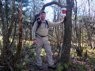
All in all, a long trip for only one mountain. No "Betsy's" on this trip, Strong hikers, several of which I had been with three weeks ago when I did my first group hike and most of them at that point had more mountains than me. Now, I am way ahead of them. Number 29 today. A two mountain day planned for tomorrow. Three days to go. I will clean up the cabin and take off on Tuesday, done or not. Weather played a strong factor.

Friday, October 8, 2010

Rusk Mountain - 3680 ft.


This climb starts out on the Spruceton Trail that eventually leads over to Hunter Mountain. I have used trail heads along Spruceton Rd. multiple times in the last three weeks for several other mountains. (West Kill and South West Hunter) This trail starts out following the Hunter Brook and once you cross a new wooden bridge over the stream and come to a notable switch-back, you leave the trail and begin the bushwhack north. It was very steep and the low under growth was thick. I had taken pity on Sarge and gave him another chance to come along. I'm not sure if it was the fact that there was no trail to follow or that I made him wear his pack, (nothing in it, but it slows him down) but he stayed much closer today.


It ended up being one of those days that I was glad that I had invested a lot of money in a good GPS because once you have climbed up the majority of the elevation, the true summit is sometimes hard to find when the top of the mountain is basically flat. It (the GPS) kept pointing me in the right direction, because finding a small canister on the top of a mountain is literally like "finding the needle in the middle of a haystack." People start bushwhacks from a variety of different locations. This leaves no discernible trail until you get close to the summit where everyone converges towards the canister. I finally picked up a herd path that led me right to it. There is always more of a feeling of satisfaction on these trail-less hikes, because anybody can follow a trail,
it takes work to find a canister. After the required picture (I take them to make sure that Sandy knows that I am actually climbing mountains, not sitting at the cabin drinking beer... that comes later) and signing into the notebook in the canister. I started the "much tougher than I thought" climb down. I had told several people prior to starting this quest that I wasn't worried about getting lost in the Catskills because when in doubt, you just find a dry stream bed or working spring, follow it until it meets with a stream, follow that until it meets with a creek, follow that until it meets with a river and follow that until it leads to a road. Using that theory, I followed the head waters of the Hunter Brook down through the Ox Hollow along a much tougher descent than I had originally planned. Sarge actually looked at me a couple of times with that "are you kidding me?" face. We made it back to the Spruceton Trail, safe and sound, and ran into the first other hikers that I've seen in several days. (Wow... people, what a concept). I am actually contemplating a new plan that has me completing this whole event. (35 in 30 days) It's not a guarantee, but I do think that I have a better chance than I thought last week after being forced off the trail due to the torrential downpours and flooding. "35 Peaks in 30 Days" still might happen...
One of the good points about this hike is, I get to pass by the strategically placed Mountain Brook Inn, my new favorite bar. A good place for a celebratory cold beer and conversation with the owner, Mark which gives me a touch with reality before I head back to Phoencia.


Day Off (the last one)

Thursday - October 7th
I woke up in the morning to guess what? Rain.... again.
But it's okay since it was a planned day off anyway. I went up to my parents house and helped with some Fall chores. A little rest for the legs and a good hamburger in Windham. The rain actually cleared out early and ushered in what should be great weather for at least the next couple of days.
Tomorrow... a true bushwhack up to the top of Rusk Mountain.

Thursday, October 7, 2010

Table Mountain - 3847 ft.

Today was a two summit day to the last mountains that I had left that are over 3800 ft. (Table & Peekamoose Mountains) This is also the last of State maintained trail hikes. Everything else will be "off the beaten path" from here. The 8.7 mile hike required a long drive in the morning to the trail head at the end of Denning Rd. I've become very used to trail heads that are at the end of long valley drives on dead end roads. Although it took almost an hour to get there, it was one of the more rewarding drives over scenic mountain roads and finally following the Neversink River valley to the end of Denning Rd. I had woke up to overcast skies , but at least no rain. The temperature was cool, but cool is a good thing once you get moving. This would be my fifth multiple mountain day since I've been here which has helped me keep close to my schedule even though the weather hasn't cooperated.


The first 1.3 miles was on a mostly level trail along peaceful mountain streams. Sarge was happy to be back on the trail after a few days off for him due to bad weather and private property crossings. (unfortunately, by the end of the day, I would find that after three weeks up here, Sarge has decided that he is a mountain dog who is as free as the coyotes to do and go where he wants and not listen to me)


The initial yellow blaze trail led to the well marked blue blaze Peekamoose / Table trail that required a couple of early stream crossings. Fortunately, with bridges across each one, it didn't require me to get wet. The log bridge to the left had sustained a little damage in the recent floods and wasn't quite as stable as I think it used to be. Sarge started across it and then decided to go back and take his chances with the fast moving water.


Once the climb up Table started, it was one of those relentless climbs that seemed to go on forever. To make things worse, it had one of those false summits that lead you to believe that you are on the top only to find out there is still much more to go. As I got closer to the actual summit, I walked up into the clouds as you can tell from the misty picture to the left. The trail across the true summit is narrow and closed in through thick conifers. You really feel like you are in a different world walking through the mist with moss covered rocks and trees all around you. Because it is so thick, you can't see anything from the top but it was still one of the more beautiful summits that I have been on. This was mountain #26 and #27 was really only a short distance away. The trip into the col went down over large moss covered rocks and through a lot of running water, since it had been raining for the last three days. The weather was finally starting to improve and the sun actually peeked out a couple times as I continued on.


This day is continued on the next post... (Peekamoose Mountain and a long walk out)

Peekamoose Mountain - 3843 ft.


The overcast skies finally started to break up around 11 am and I saw the sun for the first time in days. The climb to the summit of Peekamoose went surprising quick since there was only 0.85 miles distance between the two and drop to the col was minimal.

The summit has a great photo opportunity with the large rock pictured below to pose on. The trail opened up onto a couple of rock ledges that afforded the first good views in several days.
The final walk out to the parking area was 3 miles of steady descent through open woods. Sarge tested my patience by constantly chasing birds, chipmunks and squirrels off the trail and disappearing for long periods of time. He gets so fixated that he won't listen to anything or come when he is called. Although beating him with my hiking stick came to mind, I chose to put him on a short lease and have him walk right next to me for the rest of the way out. Since this was the last trail hike and everything that is left are bushwhack's, he may have done his last mountain.
The trip down took us past "Reconnoiter Rock" A large stone that appears to be literally balancing on the edge of a large rock conglomerate.
We reached the parking area at 12:30 am. Four hours for an almost nine mile hike over two mountains. I had to call my brother-in-law from the top of the mountain and let him know that we would be coming out earlier than when I had originally planned for him to meet us. I forget lately when I am making my time estimates that I am a lot stronger than I was three weeks ago. We got to the Peekamoose parking area and I had just sat down on a stone to wait and Mike came driving around the corner 20 seconds later. Perfect timing.


Tuesday, October 5, 2010

Bearpen Mountain - 3600 ft.

I really hoped to have completed this mountain yesterday along with Vly, but since it rains almost every f#@king day up here, I had to stretch it out for another day. I took a chance with private property and drove my truck all the way up to the col on the wood road that I walked up yesterday. (I didn't think that I would run into anyone on a rainy Tuesday morning) Since I had already walked up it once and the col is where I would have continued up to Bearpen, I don't think it's cheating since I was basically starting where I had left off. I was better prepared today, wearing my best Gortex gear and nothing made of cotton.
I started out on an ATV trail that led me to a freshly cut snowmobile trail. After a couple of steep climbs and a long walk on a flat ridge, the trail met back up with another ATV trail that led up to the summit. Over my shoulder in the picture to the right should be a spectacular view, but oh yeah, it's still f#@king raining....


Being able to drive halfway up the mountain let me get to the summit in about an hour and back down in 45 minutes.

The hunting cabin in the picture to the right sits right in the col between the two mountains. It was occupied over the weekend because when I first got to it on Monday morning, there were ice cubes on the ground just off the deck were they had been recently dumped out of a cooler. The table underneath the covered porch, made a good staging area two days in a row to check my maps, get a compass bearing and reset my GPS. It would have been more efficient to get both of these mountains in one day but I wasn't properly prepared for the weather yesterday. No harm done, I've got 25 down and an even 10 more to go...

Monday, October 4, 2010

Vly Mountain - 3529 ft.

Today was supposed to be a two mountain day, Vly and Bearpen. I got an early start in hopes of beating the rain. Just my luck, the Catskills were having a drier than normal summer until I got here and now they've had more rain in a week than they normally get all year. The trail head that I chose as usually starts at the end of a dead end road. A mile walk up a pretty well maintained hard-scrabble road, with private property on each side, led me to a hunting cabin where I borrowed their covered porch for a few minutes to put on my rain gear. Unfortunately, unlike the warm weather rain that the young guys and I hiked in last week, this was cold rain.
Vly is technically a bushwhack, but I was able to pick up a herd path towards the summit once I reached the col. I followed it along a flat ridge and then up a long climb to the top, checking the GPS every so often to make sure I was on the right path. It was a tight trail closed in by vegetation. That means you just get wet walking through it. There was a thermometer on a post at the cabin that said it was 48 degrees. It kept getting colder as I got higher in elevation. The path eventually led me right up to the canister where I signed in and took the above picture. It was a slippery, wet decent back to the col where a decision had to be made. Even with rain gear, I was soaked and cold. My hands were numb and even though I did have gloves, they were wet and not doing any good. After checking the maps and looking at the sky once more, I decided it was better to hit only one mountain and live to fight another day. I will likely come back tomorrow (weather permitting) and finish Bearpen. I'll probably drive my truck all the way up to the hunting cabin on the wood road (I don't think that they will tow it from there) and save that first one mile walk.
On a side note; it keeps amazing me after living in and around Raleigh for so many years how technology has failed to find its way to the Catskills and upstate NY. I stopped in the town of Fleischmanns today to get gas. It is a small mountain community with several old Jewish hotels. The Citgo station (a gas card that I happen to have) had to "call in" my purchase and I had to sign for it on one of the old 1970's ditto sheets. I heard this from a comedian once, but I felt that when I was leaving that I had to "get my truck up to 88 mph just to get back to 1985."
Unfortunately only one mountain instead of two, but there are still nine days left and only 11 mountains to go...

Sunday, October 3, 2010

Halcott Mountain - 3537 ft.


The usual route up Halcott Mountain starts at a small parking area along side NY highway 42. A short trail leads up to the unnamed waterfall to the right. Since this was going to be my first solo "true bushwhack", I took the time to scout it out the day before and decided that there was a much easier approach from south from the unpaved Upper Birch Rd. By using a combination of my compass, map and GPS, I followed what appeared to be the least steep route north then broke east when I reached a ridge. The first part of the climb went through mostly deciduous forest and was fairly open. Towards the top it got much thicker and slow going. I kept checking my position on the GPS and worked my way to the last contour circle. The very last push to the summit was up the only rock cliffs that I had seen all morning. I kept moving to the highest point that I could see and picked up a small herd path that led me right to the canister. I signed in and called Sandy from the summit. All that was left was to retrace my steps and find my truck.

Mountain #23, only twelve more to go. Since I had tried to find the easiest way to the top, I decided to take the steepest way down. It goes a little quicker working with gravity instead of against it. That, and finding an old wood road about half way down got me out and back the truck in about an hour. I had gotten an early start just because it was a bushwhack and I was being cautious, but I ended up getting out so quick that it was too early, being Sunday, to have the ceremonious celebration beer. So I went with "celebration breakfast."