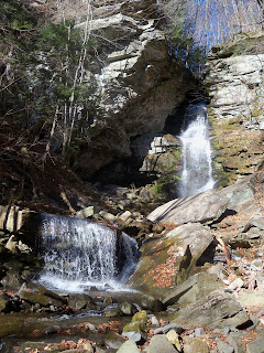
For the rest of the day, I took pictures of waterfalls, checked out tr
 ail-heads, parking areas and access roads for the mountains that I would be climbing the next two days. The next step... finding a place to stay. The issue at hand is that I had saved the three most remote mountains for last. The phrase "you can't get there from here" really comes into play. There are no "equiped" towns close to the access points that I had chosen or had been chosen for me in the case of the group hike on Sunday. As I drove around, I saw a sign that I had passed several times last month for the Alpine Inn (http://www.thealpineinn.com/) Off season, I got a great deal on a clean room in a great location. So, the next morning, the adventure continues...

Fir Mountain - I had read a lot on the Internet about the best way to approach this summit, but the best advice came from a lady I met on a group hike last month who said to take the Pine Hill-West Branch Trail up from County Road 47 to the Biscuit Brook lean-to and then "bushwhack" Northeast to the summit of Fir. The approach to the lean-to consisted of a short, but steep initial climb and then about a mile and a half flat walk to the shelter. At that point, I switched to GPS and followed a steady climb up a ridge toward the summit. It was again, one of those thick undergrowth climbs that completely slows your progress and threatens to untie your shoes and steal all your equipment. Towards the top, you work your way around a couple of rock ledges and actually get to see a little snow in places that the sun can't reach. This ended up being one of those summits that I'm glad that I turned around once in a while because the "herd paths" were not easy to follow and I may have missed the canister if I didn't look back and say "damn, there it is."
 Luckily, I hadn't lost all my physical conditioning in my month back home, but nothing about this mountain was easy. The two mile trail walk before you even start climbing made for a long two walk back out on tired legs. To make matters worse, when I started back down, I didn't keep a close watch on my GPS and managed to miss my ridge and came down a much steeper path than what I went up. As I had found out on earlier mountains, if you miss the ridge and even get a little to the left or right of it, it becomes almost impossible to get back over it. As much as you try to bare to one direction or the other, the terrain forces you to go where it wants you too. That ended up taking me close to a half a mile beyond where I wanted to join back up with the trail at the lean-to. Even though the trip back out was mostly flat, those two miles seemed like forever. The round trip ended up being about eight miles altogether and I had to keep reminding myself that I still had 11 miles and two mountains to go the next day.

Good to see you back on the trail!
ReplyDelete